


Speed, Velocity and Motion Graphs for SS 1
Speed measures distance travelled per unit time, whereas velocity includes direction. The gradient of a distance-time graph indicates speed.
Read guide
Teacher/Educational Writer
Royal Alikor is an educator with six years of classroom teaching and three years of elementary school leadership experience and is still teaching. He develops and reviews practical, curriculum-aligned learning materials for Nigerian schools and teachers.
Lessons ◉ 0 views
Speed measures distance travelled per unit time, whereas velocity includes direction. The gradient of a distance-time graph indicates speed.
Read guide→
Lessons ◉ 0 views
Acceleration is the rate at which velocity changes. For constant acceleration, equations connect initial velocity, final velocity, time and distance.
Read guide→
Lessons ◉ 0 views
Scalars such as mass and time have magnitude only. Vectors such as force and displacement have both magnitude and direction and require directional…
Read guide→
Lessons ◉ 0 views
Surface tension makes liquid surfaces resist stretching, while viscosity resists flow. Fluid speed and behaviour depend on these properties and conditions.
Read guide→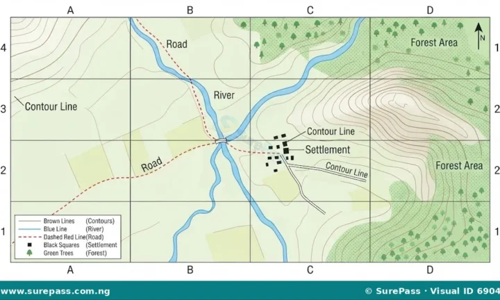 Lessons ◉ 0 views
Topographic maps use contours to show relief, symbols to represent features and scale to calculate distance. A north arrow helps establish direction.
Read guide→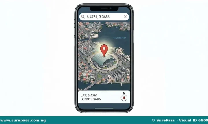 Lessons ◉ 0 views
GPS estimates positions from satellite signals; GIS combines spatial information into maps and analyses patterns useful for planning and navigation.
Read guide→
Lessons ◉ 0 views
Fundamental SI quantities include length, mass and time. Derived quantities such as speed and force combine base units, so conversions must remain consistent.
Read guide→
Lessons ◉ 4 views
Distance is the total length travelled, while displacement gives the straight-line change in position and direction between starting and finishing points.
Read guide→ Lessons ◉ 0 views
Weather describes short-term atmospheric conditions, while climate is the long-term pattern. Temperature, rainfall, wind and pressure are key elements.
Read guide→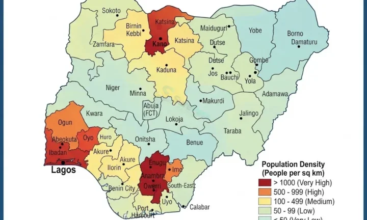 Lessons ◉ 0 views
Nigeria's population is unevenly distributed because of jobs, transport, land and services. Settlements range from scattered villages to dense cities.
Read guide→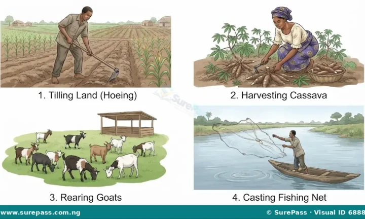 Lessons ◉ 0 views
Local economic activities include farming, trading, transport and services. Their growth depends on resources, demand, skills and access to markets.
Read guide→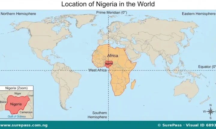 Lessons ◉ 0 views
Nigeria lies in West Africa and borders Benin, Niger, Chad and Cameroon. Its landscape includes coastal lowlands, river basins, hills and plateaux.
Read guide→Pick your class and subject. SurePass opens the matching lesson shelf and keeps the clock with you as you move around the site.
You stayed with it for 25 focused minutes. That counts.