



ARTICLE CONTENTSOn this page 6 sections
Physical Features of the Immediate Environment
Performance Objectives
By the end of the lesson, students should be able to:
- identify physical features of the immediate environment;
- observe physical features identified.
Introduction to Physical Features
The Earth’s surface is made up of many different natural elements. These natural elements, which are not created by humans, are known as physical features. They shape the landscape and influence how people live and interact with their surroundings.
Physical features include landforms like hills and mountains, water bodies like rivers and streams, and other natural elements such as rocks, soil, and vegetation. The study of these features helps in understanding the environment and its impact on human activities.
Types of Physical Features
The immediate environment, whether it is around the school, home, or community, contains various physical features. Recognising these features is the first step to understanding the local geography.
Hills and Mountains
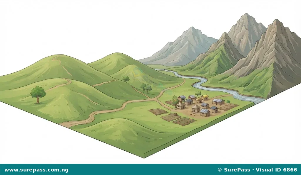
Hills are elevated landforms that rise above the surrounding terrain, but are generally lower and less steep than mountains.
Mountains are large, natural elevations of the Earth’s surface, rising to a great height and often having steep sides and a pointed or rounded top.
In Nigeria, examples of hills include the Idanre Hills in Ondo State and the Shere Hills in Plateau State. Mountains or high plateaus include parts of the Mambilla Plateau in Taraba State. These features can be identified by their height and slope compared to the flatter areas around them.
Rivers and Streams
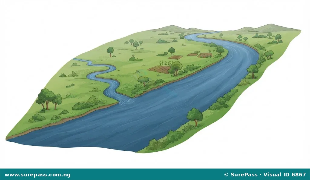
A river is a large natural stream of water flowing in a channel to the sea, a lake, or another river.
A stream is a small, narrow river or a natural flow of water that is smaller than a river.
Rivers and streams are common water bodies. In Nigeria, major rivers include the River Niger and River Benue. Smaller streams can be found flowing through many communities, especially during the rainy season. They are identified by their flowing water and the channels they carve into the land.
Rocks
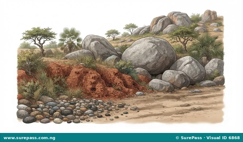
Rocks are solid, naturally occurring masses of mineral matter that make up the Earth’s crust.
Rocks can be found in various sizes, from large outcrops and boulders to small pebbles. They differ in hardness, colour, and texture. In many parts of Nigeria, rocks like granite are common, often seen as large formations or used as building materials. Laterite, a reddish soil-like rock, is also common, especially in areas with high rainfall and distinct dry seasons.
Soil
Soil is the loose, uppermost layer of the Earth’s surface, composed of mineral particles, organic matter, water, and air, which supports plant growth.
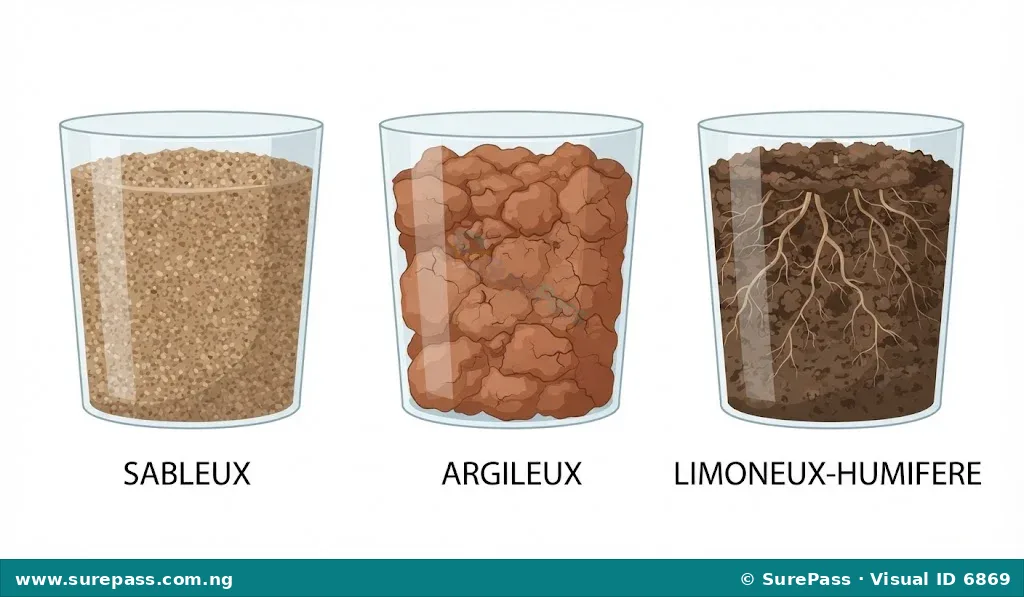
Soil is essential for agriculture and supports most plant life. Different types of soil have distinct characteristics. For example, sandy soil feels gritty and drains water quickly, while clayey soil feels sticky when wet and holds water well. Loamy soil is a mixture that is good for farming. Soil can be identified by its colour, texture, and how it feels when touched.
Relief
Relief refers to the variations in elevation and slope of the Earth’s surface, describing whether an area is flat, undulating, hilly, or mountainous.
The relief of an area describes its general shape and height. A flat area has low relief, while a mountainous area has high relief. Observing the relief involves noticing how the land rises and falls. For instance, the immediate environment might be generally flat, gently sloping, or have noticeable small hills.
Drainage
Drainage is the natural or artificial removal of surface and sub-surface water from an area.
Drainage patterns describe how water flows across the land. This includes natural channels like streams and gullies, as well as man-made drains and gutters. Observing drainage helps understand how water moves through the environment, especially during rainfall, and where it collects or flows away.
Weather and Climate
Weather refers to the day-to-day atmospheric conditions of a place, including temperature, rainfall, wind, and humidity.
Climate is the average weather condition of a place over a long period, usually 30 years or more.
While weather changes daily, climate describes the typical conditions. For example, Nigeria generally has a tropical climate, but the weather on any given day can be sunny, rainy, or windy. Observing weather involves noting the temperature, whether it is raining, how strong the wind is, and the amount of cloud cover.
Vegetation
Vegetation refers to the plant life that covers an area, including trees, shrubs, grasses, and other plants.
Vegetation can be natural, growing without human intervention, or cultivated, planted by people for various purposes. In Nigeria, common natural vegetation types include forests in the south and savannas in the north. In the immediate environment, vegetation might include trees, shrubs, grasses, and cultivated plants in gardens or farms. Different types of vegetation can be identified by their height, density, leaf type, and overall appearance.
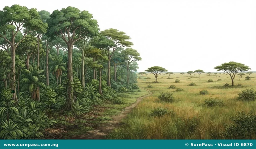
Observing Physical Features in the Immediate Environment
Developing observational skills is crucial for understanding geography. By carefully looking at the surroundings, students can identify and describe the physical features present.
The process of observing physical features involves the following steps:
- Walk Around: Take a walk around the school compound, home area, or a nearby community area.
- Look Carefully: Pay close attention to the land, water, plants, and sky.
- Identify Landforms: Notice if the ground is flat, sloping, or if there are any small rises (hills) or depressions.
- Identify Water Bodies: Look for any flowing water (streams, rivers, gutters) or standing water (ponds, puddles).
- Examine Rocks and Soil: Observe the types of rocks present (if any) and the colour and texture of the soil.
- Note Vegetation: Identify the different types of plants, trees, and grasses. Are they natural or planted? How dense are they?
- Observe Weather: Pay attention to the current weather conditions – is it sunny, cloudy, rainy, or windy?
- Describe What You See: Mentally or physically note down the characteristics of each feature.
For example, while walking around the school, one might observe a gentle slope (relief), a small gully where water flows during rain (drainage), reddish soil (soil type), and various planted trees and grasses (vegetation).
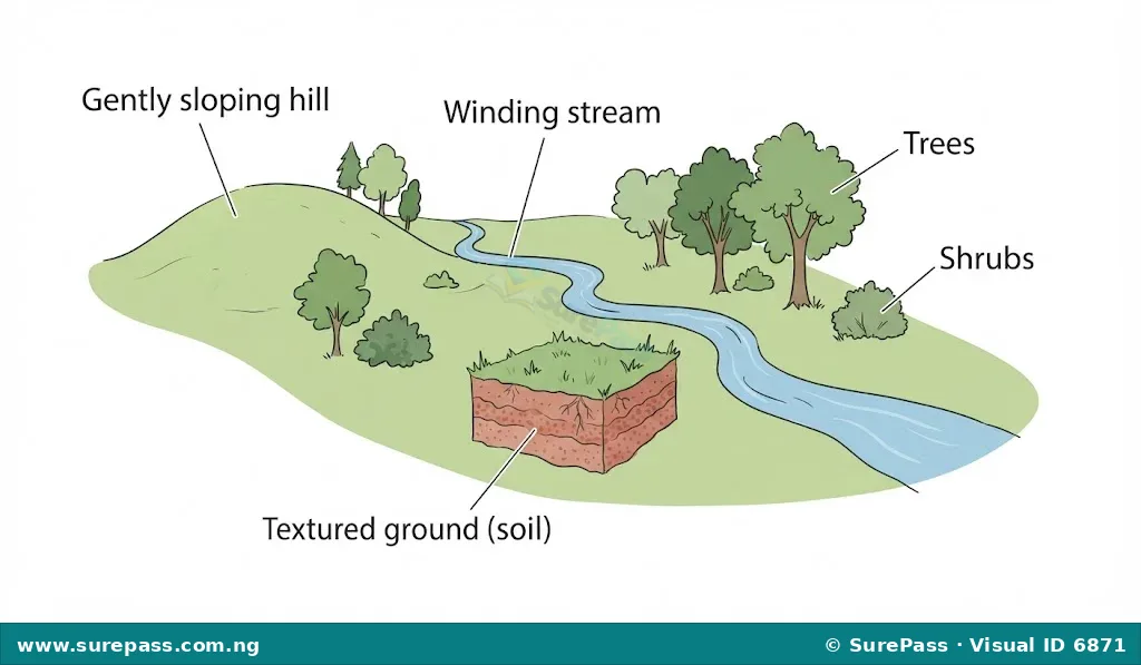
Drawing Physical Features
Drawing is an important skill in geography as it helps to represent and communicate observations of the environment. Drawing physical features allows for a visual record of what has been identified and observed.
To draw physical features accurately, consider the following:
- Use Appropriate Materials: Use pencils for sketching, rulers for straight lines (if needed for boundaries), and paper (plain, graph, or cardboard) for the drawing surface.
- Sketch Lightly First: Begin by lightly sketching the main outlines of the features. For example, draw the general shape of a hill or the path of a stream.
- Represent Relief: Show hills and mountains using curved lines to indicate their slopes and peaks. Flatter areas can be drawn with straighter, more level lines.
- Represent Water Bodies: Draw rivers and streams as winding lines or channels. Use shading or wavy lines to suggest water.
- Represent Vegetation: Use different patterns or symbols to show trees, shrubs, and grasses. For example, small circles or irregular shapes for trees, and short strokes for grass.
- Represent Rocks and Soil: Show rocks as irregular shapes. Indicate soil by its colour or texture, perhaps using light shading.
- Add Details: Once the main features are in place, add more details to make the drawing clearer. For example, show the direction of water flow in a stream or the density of trees in a forest.
- Label Features: Clearly label each physical feature in the drawing to ensure it is easily identifiable.
- Consider Perspective: Think about whether you are drawing a bird’s-eye view (like a map) or a ground-level view (like a landscape picture). For SS1, a simple landscape view is often sufficient.
Topographic maps are excellent examples of how physical features like relief, rivers, and vegetation are represented using symbols and contour lines. While creating complex topographic maps is a later skill, observing how they depict features can inspire simpler drawings.




0 comments
Open the discussion when you need it. Comments stay collapsed until requested so the initial article remains light.