


ARTICLE CONTENTSOn this page 6 sections
Concept of Geography
Performance Objectives
By the end of the lesson, students should be able to:
- explain the meaning of geography;
- distinguish between the branches of geography;
- identify basic geographic tools;
- discuss the importance of geography.
Meaning of Geography
Geography is the scientific study of the Earth’s surface, including its physical features, climate, population, and how human activities interact with the natural environment.
It explores where things are located, why they are there, and how they change over time. Geography helps us understand the complex relationships between people and their surroundings, from local communities to the entire planet. It combines elements of both natural sciences and social sciences to provide a holistic view of the Earth.
Branches of Geography
Geography is a broad field of study, and it is divided into several branches to allow for more focused research and understanding. These branches help geographers specialise in different aspects of the Earth and its human-environment interactions. The main branches of geography include physical geography, human geography, regional geography, and practical geography.
Physical Geography
Physical geography focuses on the natural features and processes of the Earth’s surface. It examines the non-human aspects of the environment.
This branch studies elements such as landforms (mountains, rivers, plains), climate patterns (temperature, rainfall, winds), vegetation (forests, grasslands), soils, and water bodies (oceans, lakes, rivers). Physical geographers investigate how these natural systems work, how they interact with each other, and how they change over time due to natural forces.
Human Geography
Human geography is concerned with the study of human populations, their activities, and their impact on the Earth’s surface. It explores how people organise themselves and interact with their environment.
This branch examines topics like population distribution, settlement patterns (villages, towns, cities), economic activities (agriculture, industry, trade), cultural practices, political systems, and transportation networks. Human geographers analyse how human societies are organised, how they use and modify the environment, and how these interactions create distinct cultural landscapes.
Regional Geography
Regional geography involves the study of specific regions of the Earth. It combines both physical and human aspects to provide a comprehensive understanding of a particular area.
This branch focuses on describing and analysing the unique characteristics of a region, including its physical environment, human population, cultural traits, economic activities, and political organisation. Regional geographers aim to understand how different elements interact within a specific geographical area to give it its distinct identity. For example, studying the Niger Delta region would involve looking at its wetlands, oil production, population density, and local cultures.
Practical Geography
Practical geography, also known as geographical techniques or geomatics, deals with the methods and tools used to collect, analyse, and present geographical information. It focuses on the application of geographical knowledge and skills.
This branch includes skills such as map-making (cartography), surveying, remote sensing, and the use of Geographic Information Systems (GIS). Practical geography provides the essential techniques that geographers use to conduct their studies and solve real-world problems. It is about how geographical data is acquired, processed, and communicated.
Tools of Geography
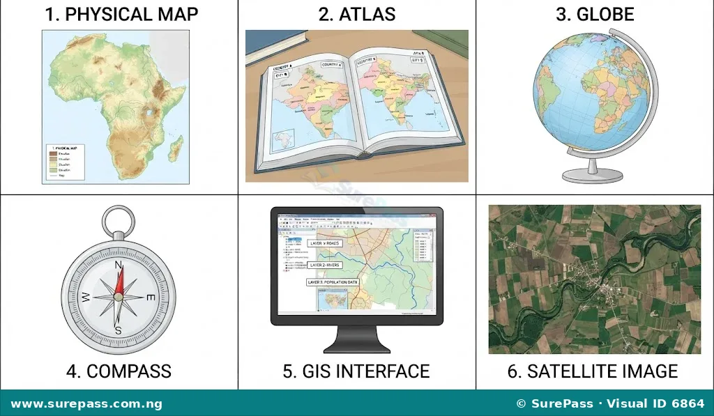
Geographers use various tools to collect, analyse, and present information about the Earth’s surface. These tools are essential for understanding spatial relationships, patterns, and processes. Identifying these basic tools is a fundamental skill in geography.
Maps
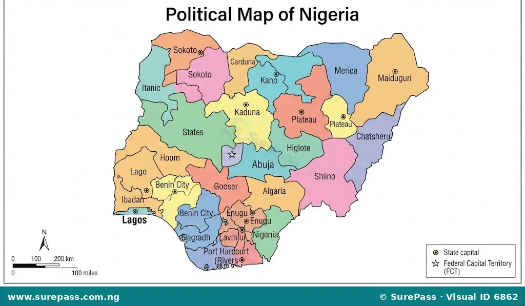
A map is a flat representation of the Earth’s surface or a part of it, drawn to scale. Maps show the location of physical features like rivers, mountains, and roads, as well as human features like cities and boundaries.
Maps use symbols, colours, and labels to convey information. They are fundamental tools for navigation, planning, and understanding spatial distribution.
Atlas
An atlas is a collection of maps, usually bound together in a book. It can contain various types of maps, such as political maps, physical maps, thematic maps (showing specific data like population or climate), and historical maps.
Atlases are valuable resources for comparing different geographical features and understanding global or regional patterns. They often include additional geographical information like statistics and facts.
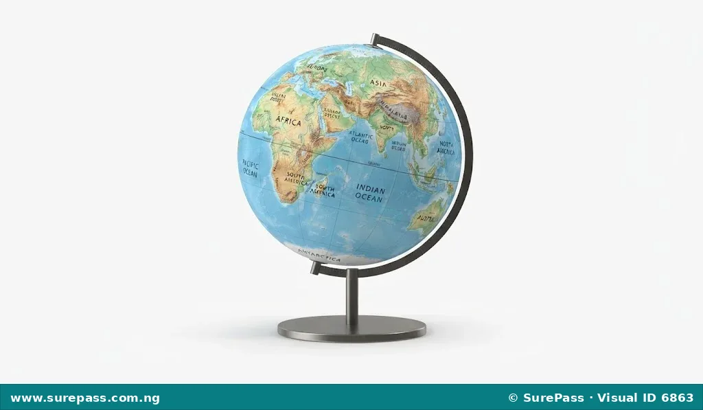
Globe
A globe is a spherical model of the Earth. It provides the most accurate representation of the Earth’s shape, the relative sizes of continents and oceans, and the distances between places.
Unlike flat maps, a globe does not distort the shapes or sizes of landmasses, especially those near the poles. It is useful for understanding the Earth’s rotation, time zones, and the true directions of places.
Compass
A compass is an instrument used for determining direction. It typically has a magnetised needle that points to the Earth’s magnetic North Pole.
Compasses are essential for navigation on land and sea, helping people find their way and orient maps correctly. They are simple yet powerful tools for understanding cardinal directions (North, South, East, West) and intermediate directions.
Geographic Information Systems (GIS)
Geographic Information Systems (GIS) are computer-based systems designed to capture, store, manipulate, analyse, manage, and present all types of geographical data. GIS allows users to create interactive queries, analyse spatial information, edit data, maps, and present the results.
For example, a GIS can be used to map population density, track environmental changes, or plan urban development. It integrates various layers of information, such as roads, rivers, and land use, onto a single digital map.
Remote Sensing
Remote sensing is the process of acquiring information about an object or phenomenon without making physical contact with it. This is typically done using sensors on satellites or aircraft that collect data from a distance.
Examples of remote sensing include satellite imagery and aerial photographs. This technology helps geographers monitor large areas, detect changes in land cover, assess natural disasters, and study weather patterns without needing to be physically present at the location.
Importance of Geography
Geography is important for several reasons, as it helps us understand the world around us and address many challenges facing society today. Its relevance spans across various aspects of human life and environmental management.
- Understanding the Environment: Geography helps us understand natural processes like climate change, soil erosion, and water cycles. This knowledge is crucial for environmental conservation and managing natural resources sustainably.
- Resource Management: It provides insights into the distribution of natural resources such as minerals, water, and forests. This information is vital for effective planning and management of these resources for economic development and future generations.
- Urban and Regional Planning: Geographers contribute to planning cities and regions by studying population distribution, land use, transportation, and infrastructure needs. This helps in creating well-organised and sustainable human settlements.
- Disaster Management: By studying natural hazards like floods, earthquakes, and droughts, geography helps in predicting, preparing for, and mitigating the impacts of natural disasters, thereby saving lives and property.
- Navigation and Exploration: Maps, globes, and GPS (Global Positioning System, a common application of geographic principles) are essential for navigation, travel, and exploring new areas, whether for personal journeys or scientific expeditions.
- Understanding Cultural Diversity: Geography helps us appreciate the diversity of cultures, languages, and societies across different regions of the world. It explains how physical environments can influence human cultures and vice versa.
- Economic Development: It assists in understanding the location of industries, markets, and trade routes, which is crucial for economic planning, investment decisions, and fostering regional development.
- International Relations: Knowledge of geography is important for understanding geopolitical issues, international boundaries, and the relationships between countries, contributing to diplomacy and peace.




0 comments
Open the discussion when you need it. Comments stay collapsed until requested so the initial article remains light.